Normandie Position + Schiffsdaten
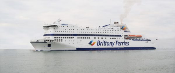
Beispielfoto einer Brittany Fähre © Viktor Forgacs
Normandie Schiffsdaten
| Bauwerft | Kvaerner Masa-Yards |
| Indienststellung | 1992 |
| Schiffstyp | RoPax-Fähre |
| Rufzeichen |
FNNO |
| Vermessung | 27,542 BRZ |
| Tiefgang | max. 6,01 m |
| Flagge | Frankreich |
| Länge | 161 m |
| Breite | 26 m |
| Fahrzeugkapazität |
575 PKW |
| Passagiere |
2123 |
| Decks | 10 |
| Kabinen | 220 |
| Höchstgeschwindigkeit | 21 Knoten |
| Reederei | Brittany Ferries |
| Route | Portsmouth-Caen |
| IMO | 9006253 |
Aktuelle Position der Normandie
Brittany Ferries Schiffe
| Name | IMO | Route | Passagiere | Flagge | Länge |
| Armorique | 9364980 | Plymouth-Roscoff | 1500 | Frankreich | 168,3 m |
| Barfleur | 9007130 | Poole-Cherbourg | 900 | Frankreich | 166,65 m |
| Bretagne | 8707329 | Portsmouth-Saint Malo, Plymouth-Roscoff | 2.056 | Frankreich | 151,2 m |
| Cap Finistere | 9198927 | Portsmouth-Roscoff-Bilbao/Santander-Rosslare-Cherbourg-Bilbao | 850 | Frankreich | 204 m |
| Galicia | 9856189 | Portsmouth-Santander | 1680 | Frankreich | 215 m |
| Mont St Michel | 9238337 | Portsmouth-Caen | 2123 | Frankreich | 173 m |
| Normandie | 9006253 | Portsmouth-Caen | 2123 | Frankreich | 161 m |
| Pont Aven | 9268708 | Portsmouth-Saint Malo-/Santander, Roscoff-Plymouth-/Cork | 2415 | Frankreich | 184 m |
| Salamanca | 9867592 | Portsmouth-Santander | 1125 | 240 m |


